 |
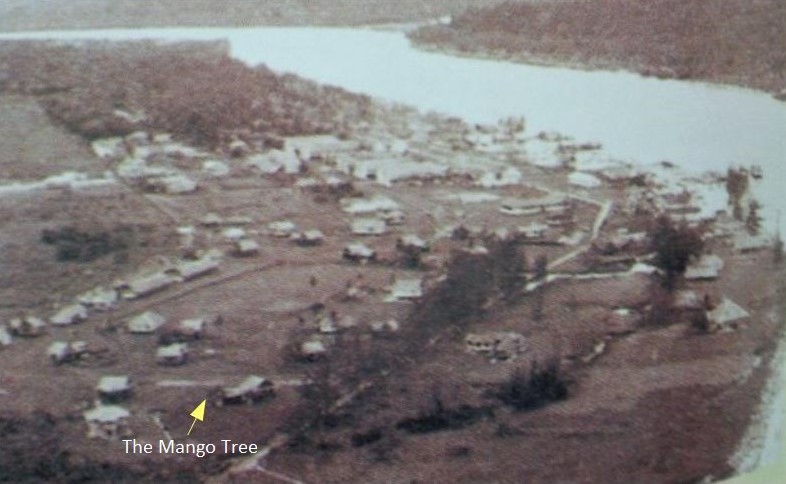
| This aerial photo portrays the landscape and limit of Bintulu town's "urban" area in the late 50's to 60's era, prior to the its first boom period beginning 1979. |
Finally my search for a documentary evidence came by in the form of a photograph that clearly shows the historical mango tree that has been the subject of my historical search after so many years. This tree is important because it is the only physical structure and a living one at that which is still standing even at this point of writing while all others in the picture above have been obliterated due to the development of Bintulu town. Thus the tree is very historical and living proof of the Bintulu that was. For more detail story of this tree check my earlier writings on it by following ...... this link. ........and also here
 |
| The Mango tree as seen today, 30 Nov'15. |
Below are pictures of the surrounding landscape of the historical Mango tree in the years around 1950-60's (black and white) and intensive development of the same area starting with the first boom period (1979-83) shown in the colour photo below . Please go to this link to know more account of the area...>>>http://bintulub4now.blogspot.my/2013/12/bintulu-town-during-first-boom-1979-83.html


No comments:
Post a Comment